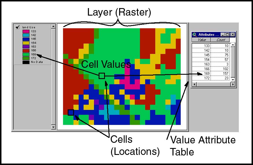
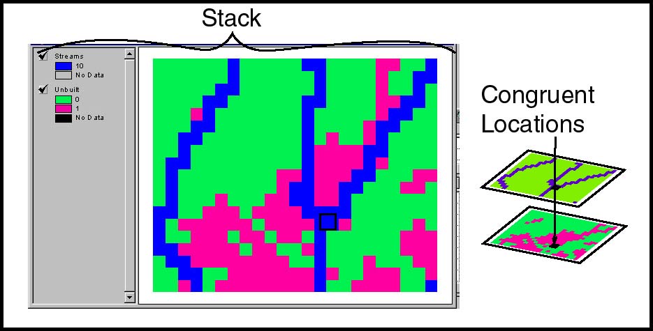
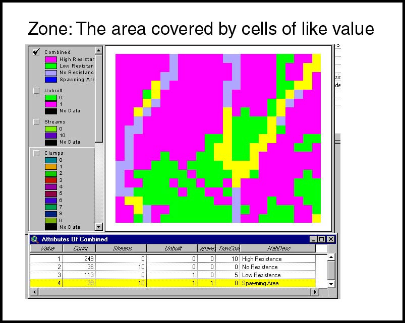
Raster Entites: A raster is an arrangement of regularly shaped, contiguous cells that fit together edge-to-edge to form a continuous layer. Typically the cells in a raster are square, but occaisionally you may see references to hexagonal rasters. The fundamental element of information in a raster GIS is a cell representing a location. Cells are arranged in layers. Each cell in a layer has a value that indicates some characteristic of that location. All cells having the same value constitute a 'zone'. A data set can be composed of many layers covering the same geographical areas.
|
Entites of Raster GIS |
|
|
Cells, Values, Layers |
|
|
Stack, Locations |
|
|
Zones |
|
Raster Associations: The hallmark of raster GIS is the broad spectrum of ways that entities may be systematically associated. The spatial regularity among the cells is what permits these associations among cells in a single layer, or among cells in other layers. These associations are quite powerful for modeling the spatial interactions or spatial questions that occur often in real life:
|
Raster Associations & Function Families |
|
|
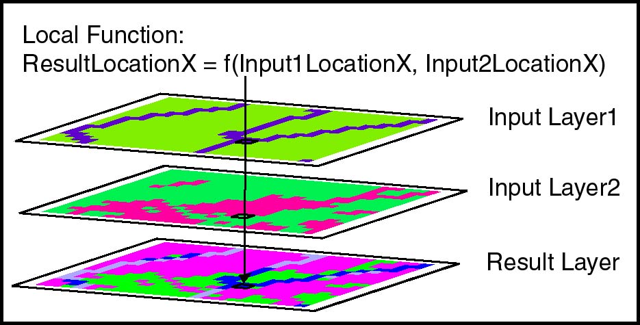
Local Relationships: Combining, merging, mathematical functions accross layers. |
|
|
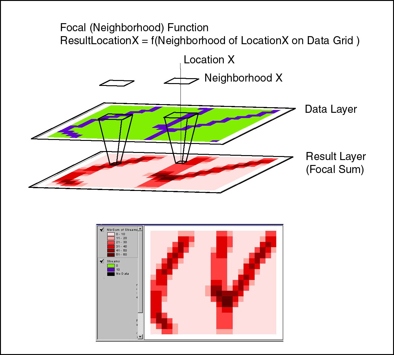
Focal Relationships: The association of a cell with its neighborhood |
|
|
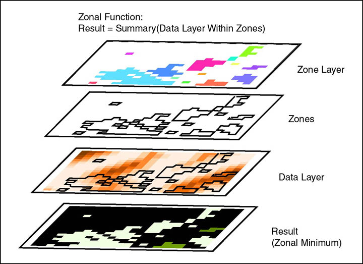
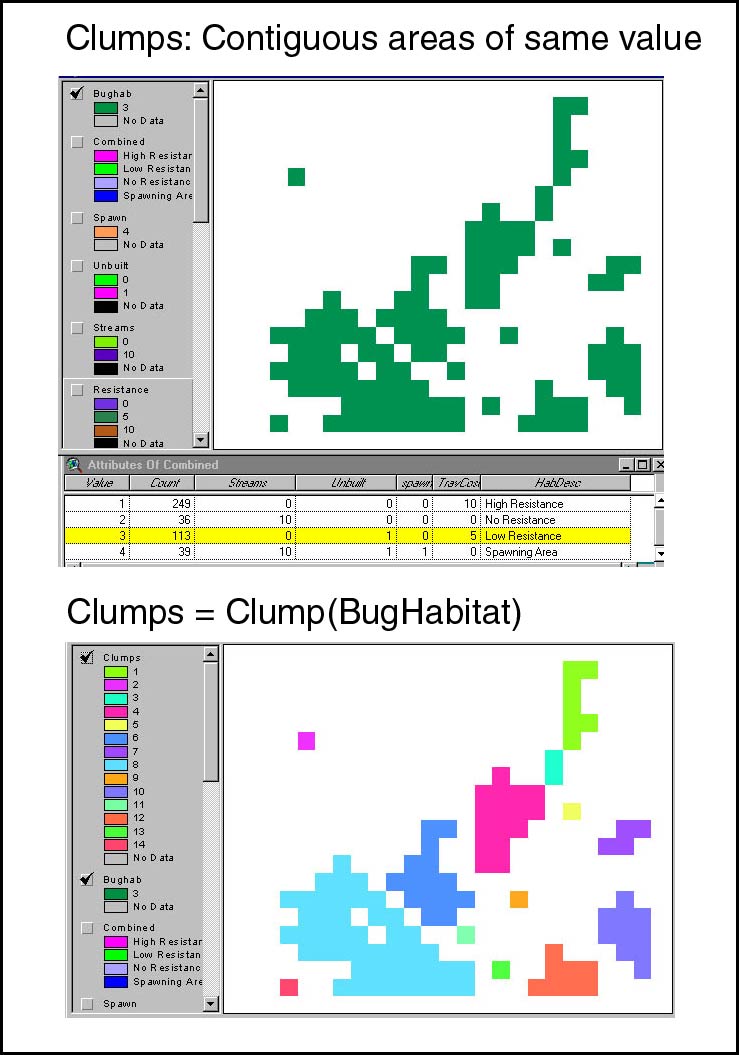
Zonal Relationships: Areas defined by a common value in a given layer. (With associated recode and clump functions to re-arrange zones) |
|
|
Incremental Functions: Proximity relationships, cost of travel, and visibility |
|

As with other information systems, the entities and associative tools are very basic, but the power is in stringing them together in creative ways to model real entities, associations and processes.